
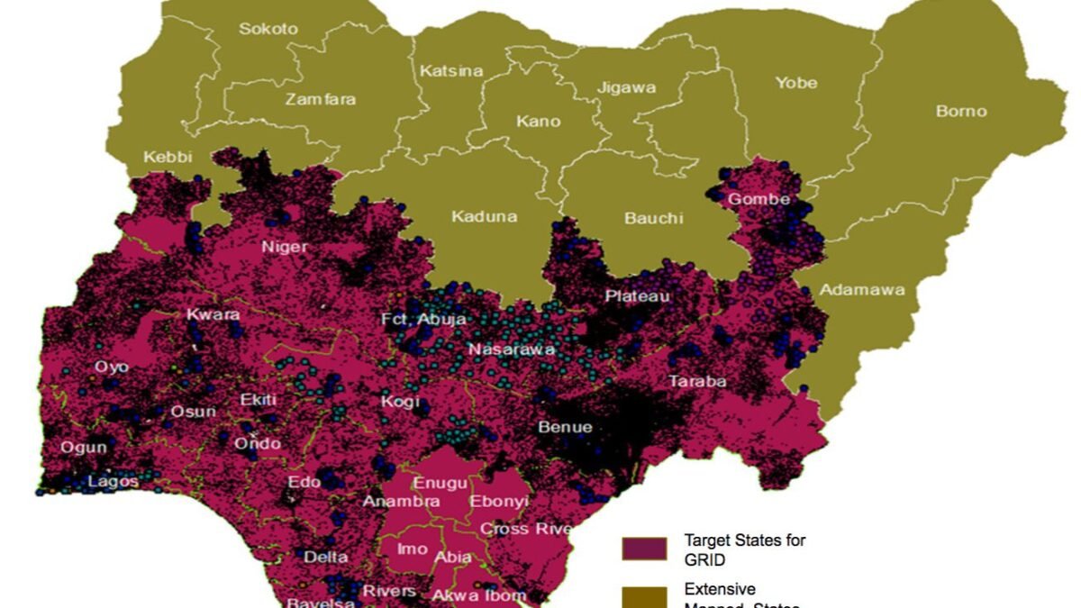
Before a government can tax a piece of land, it must know where the land is. Before it can build a road, it must know what lies in the path. Before it can respond to a flood, it must know which communities are in the basin. Before it can negotiate a border, it must have the data to define one. These are not technical observations. They are sovereignty statements, because a state that does not know its own territory in detail is a state that governs by approximation, and approximation is exactly what external actors, from multinationals to multilateral lenders, exploit when they negotiate with governments that lack the data to verify the terms they are being offered.
Nigeria’s geospatial infrastructure, the national mapping systems, land registers, satellite imagery protocols, and spatial data frameworks that should constitute the basic territorial knowledge base of Africa’s most populous state, has for decades been the quiet casualty of a governance culture that prioritises visible expenditures over foundational ones. The Office of the Surveyor General of the Federation exists. The National Space Research and Development Agency exists. What has not existed in sufficient form is the political priority that would translate their mandates into the kind of comprehensive, maintained, accessible territorial data infrastructure that modern state function requires.
The maps a state does not make are the spaces where others write their own version of the territory. Unmapped land is not ungoverned, it is governed by whoever shows up with the instruments to define it.
The consequences of this gap are concrete and compounding. Nigeria’s land administration crisis, in which property rights are contested, land titling is incomplete, and agricultural land use data is fragmented across thirty-six state systems with no interoperability, is partly a legal problem and partly a data problem. Governments cannot reform what they cannot measure. The persistent difficulty of connecting small farmers to formal credit markets, which requires documented land rights as collateral, is a downstream consequence of an upstream mapping failure. The difficulty of planning infrastructure in a country where the baseline geospatial data is incomplete or inconsistent produces a planning environment in which projects are designed in data vacuums, with predictable consequences for cost overruns and misalignment with actual on-ground conditions.
The technology landscape has shifted the opportunity calculus significantly. Satellite imagery is now commercially available at resolutions that would have been classified intelligence two decades ago. Drone survey technology has made ground-truth data collection faster and cheaper than traditional survey methods. Open-source geospatial platforms, GIS tools that require no proprietary licensing, have lowered the technical barrier to building spatial data systems. What remains is not primarily a technology problem. It is an institutional problem: building the data governance frameworks, the interdepartmental coordination, and the sustained political commitment to maintain geospatial infrastructure as a public good rather than treating it as a one-off project dependent on external funding.
There are also security dimensions that the conversation about geospatial infrastructure rarely surfaces publicly. Nigeria’s northeastern crisis, the Boko Haram insurgency and its successor dynamics, was partly managed by security forces operating in terrain they did not understand in sufficient detail to pursue effective counter-operations. Intelligence failures in conflict theatres where terrain knowledge is a force multiplier are expensive in ways that are difficult to attribute after the fact but very expensive in real time. Similarly, the farmer-herder conflicts that have intensified across the Middle Belt and northwest Nigeria as climate change alters grazing and farming patterns would be more tractable with the kind of land use data that a functioning national geospatial system would provide, not as a solution, but as a diagnostic tool that makes solutions possible.
The continental picture is important here. Several African governments have prioritised geospatial infrastructure with notable effect. Rwanda’s national land registration programme, completed with high coverage rates, has produced measurable improvements in land market efficiency, women’s land rights, and agricultural investment. Ethiopia’s investment in satellite-based agricultural monitoring has improved the precision of drought early warning systems. These are not large-budget interventions relative to their impact. They are institutional investments with compounding returns, the kind of foundational expenditure that appears in no press release but underpins everything else that actually works.
Nigeria’s mapping effort is not absent. It is insufficient, underfunded, and fragmented across institutions that do not share data with each other or with the public. Making it adequate is not a grand gesture. It is a series of administrative decisions, about interoperability standards, about open data policy, about budget allocation, about the career structures that attract and retain technical staff, that together constitute the choice between a state that knows its territory and one that governs by approximation. The backrooms of the ministries where this work happens will never generate a headline. The absence of the work they should be doing generates consequences that do.